Iceland, the land of fire and ice, is a hiker’s paradise. Doesn’t matter if you go hiking three times per week or are planning your first hike here, in Iceland. We guarantee you will enjoy hiking in Iceland to the fullest!
We have carefully selected the seven best hikes in Iceland for you, across all levels, on this stunning island.
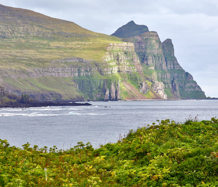
Hornstrandir
This beautiful, almost untouched nature reserve awaits you in the northernmost of Iceland – Westfjords. Hornstrandir (eng. translation – Corners beaches), also known as the territory of an arctic fox, has been inhabited since the early 1950s.
Why go?
If you like a remote place with minimum tourists (even in the high season), you should come to Hornstrandir.
Moreover, your chances of seeing rare Icelandic animals on one of the Hornstrandir hiking trails are high! We’re talking Arctic foxes, puffins, seals, and even more!
How to get there?
If you travel from Reykjavik, this could be a challenge and not a one-day thing. First, you must reach Ísafjörður – by car or take a domestic flight.
The second step is to get to Hornstrandir. Your decision here will not be difficult, because you have only 1 option – a boat! It will cost you from 10,000 to 15,000 ISK per ride. Alternatively, you may book an organized tour for 1-2 days!
Tips on visiting
- Plan your trip to Hornstrandir carefully – this nature reserve has a very short season from late June until the end of August.
- Please, don’t underestimate the weather conditions, take good water and windproof gear – to enjoy your trip to the fullest.
- There are almost no grocery stores and accommodation in the area, so take food supplies with you, and if you want to spend the night, find out about accommodation and its options in advance.
Kerlingarfjöll
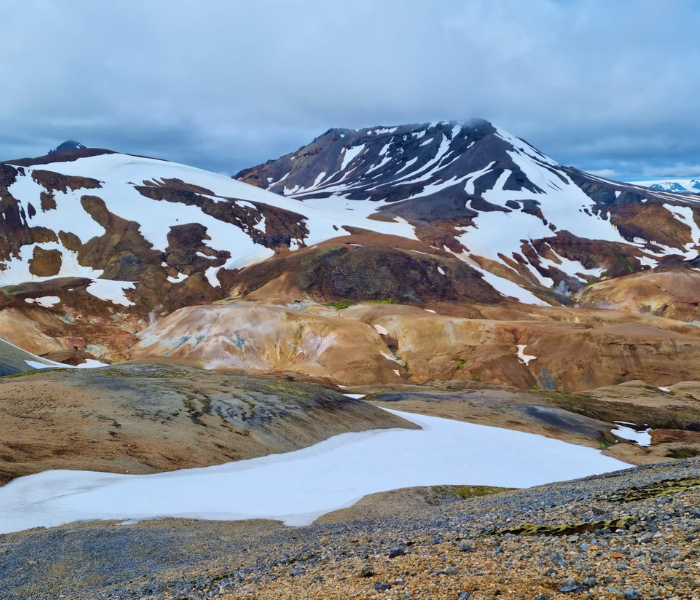
Kerlingarfjöll is a one-of-its-kind mountain range reminiscent of the planet Mars with its unusual wasteland, located in Iceland’s central highlands.
If you translate the name, it means “old Lady Mountain” and has a story behind it. Kerlingarfjöll is a more than 10,000-year-old mountain range formed by ancient volcanic activity.
Why go?
Many travellers visit the geothermal areas of Hveradalir and Mt. Kerlingarfjöll because they are unique. Even if you are not a big fan of hiking, we recommend you include this place in your day trip schedule!
How to get there?
To visit Kerlingarfjöll, you have to traverse through the so-called highlands. Unpaved F-roads provide the way to the highlands, and you need a special 4×4 car, or you have to take a bus (which goes from Reykjavik) or join a tour.
For the winter adventurous – This geothermal area is open all year. However, the F-roads typically become closed after the first snowfall. No worries, though. In this case, you can book one of the tours.
Also, the hike itself is not possible with the snow, anyway. You could only do it with the snowshoes or rent a snowmobile.
Tips on visiting
- If you want to spend a night in Kerlingarfjöll, make sure you booked it in advance (for the summer season 6 months before)
- The hike to the top of the mountain takes approximately 5-6 hours with a length of 7km from the parking lot (only in summer)
- The more challenging route is the circle around Kerlingarfjöll – a 47 km trek over the peaks. Usually, it takes 3 days, staying in a hut on the way.
- Time to relax! From the Kerlingarfjöll resort, a 1.3km walking distance is a small thermal pool.
Landmannalaugar
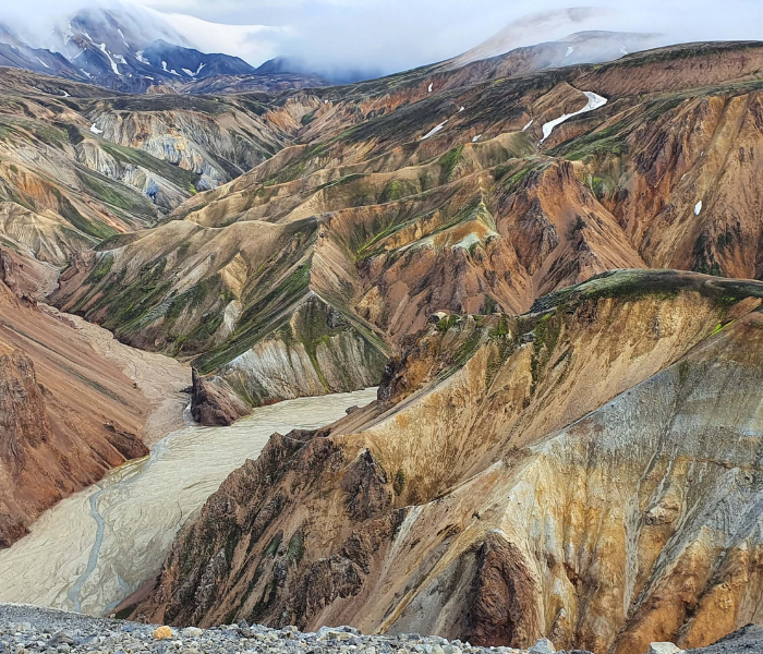
Landmannalaugar Is located in the heart of the southern highlands and is an extensive hiking area. Especially during the summer, Landmannalaugar becomes one of the best places in Iceland for hiking – whether for a 1-day trip or several days.
Why go?
No wonder this place is written down on many travellers’ bucket lists. Hiking in Landmannalaugar is an otherworldly experience. Hot springs, remote hiking trails, and multicoloured mountains show the Icelandic highlands at their best.
How to get there?
To reach the highlands, you need a car 4×4 since the F-roads are rough and unpaved. Also, the challenging part could be crossing the rivers you need to drive through.
Winter – the F-road is closed for the winter. They are open only between June and September. However, you can always join an organized tour or – the cheaper option – take the Highland bus, which goes from Reykjavik.
Tips on visiting
- The Laugavegur trek is probably the most famous in Iceland. Typically, it takes 4-5 days to cross over 50 km of marvellous, silent nature.
- Please book your accommodation a couple of months before your trip.
- Also, do not underestimate the weather conditions. Even in summertime, be ready with warm clothes, especially at night. Once you are there – there is no possibility to buy an extra layer.
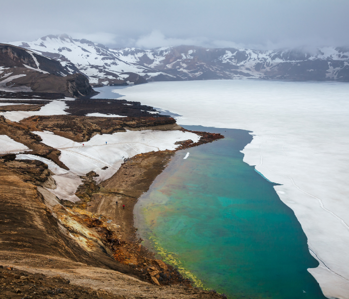
Askja
Askja is one of the most beautiful places in the north of Iceland. This place resembles a moon-like area with many craters. The biggest one – Askja – is filled with ice-cold water.
However, the smallest one – Lake Víti is a natural blue lagoon inside a volcano with a geothermal hot spring at 22 °C. So don’t forget to bring a towel with you!
Why go?
Witnessing this natural phenomenon is more than just worth it. If you reach the north, you should plan a 1-day trip to Askja – one of the island’s most remote but magical places. Also, Öskjuvatn Lake is the deepest lake in all of Iceland, with a depth of 217m.
How to get there?
Part of the experience of visiting Askja is the journey itself. Remote, isolated areas, far from cities and off the main roads, will be your main company. The only way to get there is a 4×4 vehicle. The off-roads are challenging anyway, so getting there takes some time.
There are 2 ways to reach Askja – the main access is from the North (F88) or the South (F910). Nowadays, many travel agencies offer guided trips to Askja. But it is also possible if you plan to do it on your own budget. Just don’t underestimate the need for a proper 4×4 vehicle.
Tips on visiting
- Accessible only from May to September, depending on the weather conditions (always check the road conditions at the road is beforehand)
- If you drive on your own – is it a good idea to practice crossing rivers before the Askja trip (if you have never done it before)
- Dreki Hut – right in the heart of Askja, there’s a cute authentic hut for up to 55 people
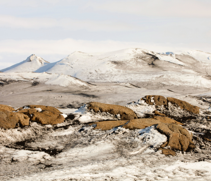
Fimmvorduhals
Have you ever heard about the hike between the glacier and the volcano? If so, it was probably Fimmvorduhals. It’s one of the most beautiful (but also most dangerous) 25 km long hiking routes in the highlands.
You can feel like you are on a completely different planet in some parts. Fimmvorduhals lies between 2 glaciers, Eyjafjallajökull and Mýrdalsjökull, and connects Skógar and Þórsmörk (you will start from one of these points).
Why go?
We recommend Fimmvorduhals whether you’re a seasoned Iceland traveller or hiking has recently become your passion!
Even if you have seen many waterfalls or have driven miles around the island, Fimmvorduhals will amaze you! Moreover, if you are into photography, you will love this hike.
How to get there?
This depends on the direction you choose. The easiest way to do the hike is from Skógar to Þórsmörk.
To get back to the starting point Skógar, you will need to take a 4×4 bus. Then you probably will need to get back to your car, so you might also need to arrange a taxi. Please make sure to book the bus in advance.
Tips on visiting
- Although doable by almost anyone, it’s important to say these trails are not for the faint of heart, small kids, or the elderly.
- If you do not feel like hiking the whole day, there is a possibility to stay overnight – Baldvinnskali or Fimmvörðuháls hut. Make your reservation in advance.
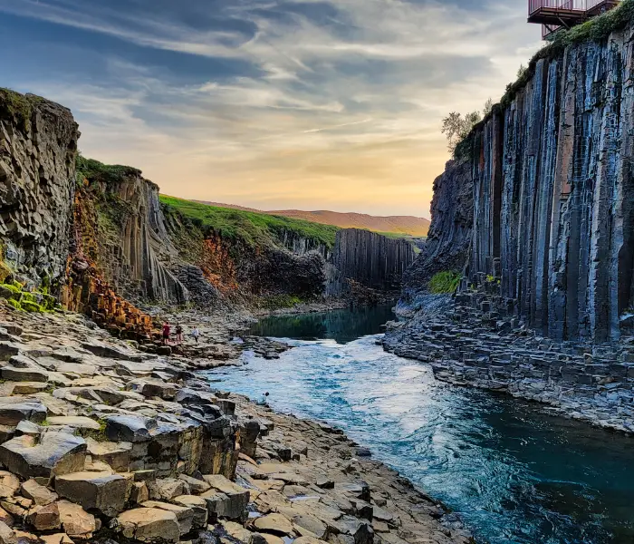
Stuðlagil
Stuðlagil is a unique basalt canyon located in East Iceland, which in recent years has established itself as one of the most exciting destinations in this country.
It became an unexpected tourist sensation right after being shown in a WOW air brochure in 2017.
Why go?
Stuðlagil is quite far from Reykjavik, but if your trip includes the Ring Road around the whole of Iceland, there should be no doubt about your stop at this stunning place.
How to get there?
- By car directly to the canyon:
Stuðlagil Canyon is located in East Iceland, about a 1-hour drive from Egilsstaðir. When leaving Route 1 (The main road, ring road) towards the canyon, you will be driving on a gravel road (923), but the road is accessible to all cars and the road is available all year round (however, be aware of the weather, especially in the winter months.)
- Stuðlagil hike (5 or 10 km)
Driving north on the main road from Egilsstaðir, passing by through Jökuldalur, take the exit down to route 923. Take the Klaustursel farm after driving 15km. By Klaustursel you will find 2 parking lots – one by the bridge over Jökla (a 10km hike to the canyon and back) and the other by Stuðlafoss waterfall (about a 5km hike back and forth)
Tips on visiting
- Since this place started to be on a bucket list for many visitors, make sure to come early to avoid crowds as much as possible.

Laugarfell Loop
If you are willing to do an off-the-beaten-path hike, Laugarfell Loop is the right place for your adventure! It is located in the Eastern part of Iceland, near Fljótsdalshreppur.
Why go?
This hike is for those surrounded by the calming nature rather than easily accessible but overcrowded famous places. You will be amazed by stunning views and picturesque waterfalls (but none of them look alike!)
How to get there?
Good news – The 4×4 car is not needed! It is a 1,5-hour detour from the Ring road, and the hike takes about 2,5 hours. So it looks more like a day trip – unless you stay overnight in Laugarfell! They also offer a hot tub, so don’t forget your swimsuit!
Tips on visiting
- Don’t miss the Hengifoss waterfall if you are in the area
- There’s a possibility of accommodation directly in Laugarfell. Make the booking in advance
- It’s better to wear waterproof gear since you will pass several waterfalls